Installing Okinawa’s Ocean Thermometers
If weather and technology cooperate during the next four years OIST researcher, Daisuke Hasegawa of the Marine Biophysics Unit will have received more than 800,000 emails from the ocean.
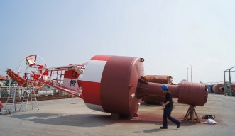
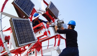
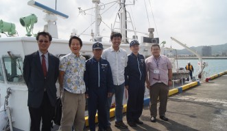
With the help of zipties, plastic mesh, rope, and the Japanese Coast Guard, a sensor now sits a few meters below the surface inside each of two hollow 10-meter steel buoys, logging the temperature every 10 minutes. Each hour Hasagawa receives an email of the data transmitted by a linked solar-powered cell phone.
This ocean communication marks the first step of a collaborative research effort with the 11th Regional Coast Guard Headquarters (the 11th HQ) of the Japan Coast Guard that began a year ago. These two sensors are the first pieces of scientific equipment placed on their red and green navigation buoys, which guide ships into port or past water hazards. Placing a series of sensors around Okinawa Prefecture waters, helps Hasegawa’s team track the meandering path of the warm, fast-moving Kuroshio current, traveling 150 km off the coast of mainland Okinawa. It brings tropical water from the south, and is essential for dispersing ocean larvae. Currently no coordinated assembly of at-sea sensors around Okinawa prefecture exists.
“This is the temperature data for the island,” says Professor Satoshi Mitari, who leads the Marine Biophysics Unit.
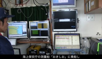
With rising temperatures affecting ocean life, currents, and global climate, this basic but vital oceanographic measurement is instrumental for OIST researchers to track trends, such as switches in the current’s path. It typically flows east of Taiwan and follows the continental shelf west of Okinawa, but has been moving around. The Kuroshio’s warm offshore flow may bring in different fish closer to shore, or its speed may damage a fisherman’s set net, says Hasegawa. “It may be a good thing, too. We don’t know yet.” He also conducts monthly ship-based surveys to measure oceanographic features such as current speed, temperature, salinity, chlorophyll, and dissolved oxygen. Over time his data will show where and how the current flows.
Satellite data is a powerful tool to estimate sea surface temperatures. But Okinawa’s cloudy skies provide challenges for satellites, and their resolution may not capture near-shore temperatures.
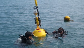
Three more sensors will eventually be logging in Minami Daito, Yonaguni and Kume Islands. Eighteen more sensors will be on moored OIST buoys placed around the island group, aided by the Okinawa Prefectural Fisheries and Ocean Research Center and the OIST Marine Science Resources Section. These deployments are the first in a slew of planned monitoring devices. A wave glider that moves through the water by wave propulsion to gather data will be launched soon. Finally, in collaboration with Woods Hole Oceanographic Institution, an underwater assemblage of oceanographic sensors and a 3-D plankton video camera will sit in waters off the Churaumi Aquarium in late summer, powered by a long extension cable connected to the aquarium. Each of these instruments give an enhanced view of nearshore waters, and the group can determine how the corals are connected to the movement of the current.
“We have such great access to coral reefs, that I thought we should invest in this area,” says Mitarai.
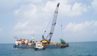
Ship time is costly to deploy equipment, so it makes sense to piggyback on other missions. In turn, the 11th HQ of the Japan Coast Guard can use OIST’s oceanographic data, which could help them predict the path of an oil spill. “It’s very meaningful,” says Takuma Kimura of the 11th HQ. “Our agreement stipulates that it’s for both our benefits.” The temperature data will be online for anyone to access, and Hasegawa foresees interest from fisherman.
“These pieces of equipment will eventually give us a large and connected glimpse of what the ocean around Okinawa is doing, but in real-time,” says Mitarai.
Specialty
Research Unit
For press enquiries:
Press Inquiry Form


