


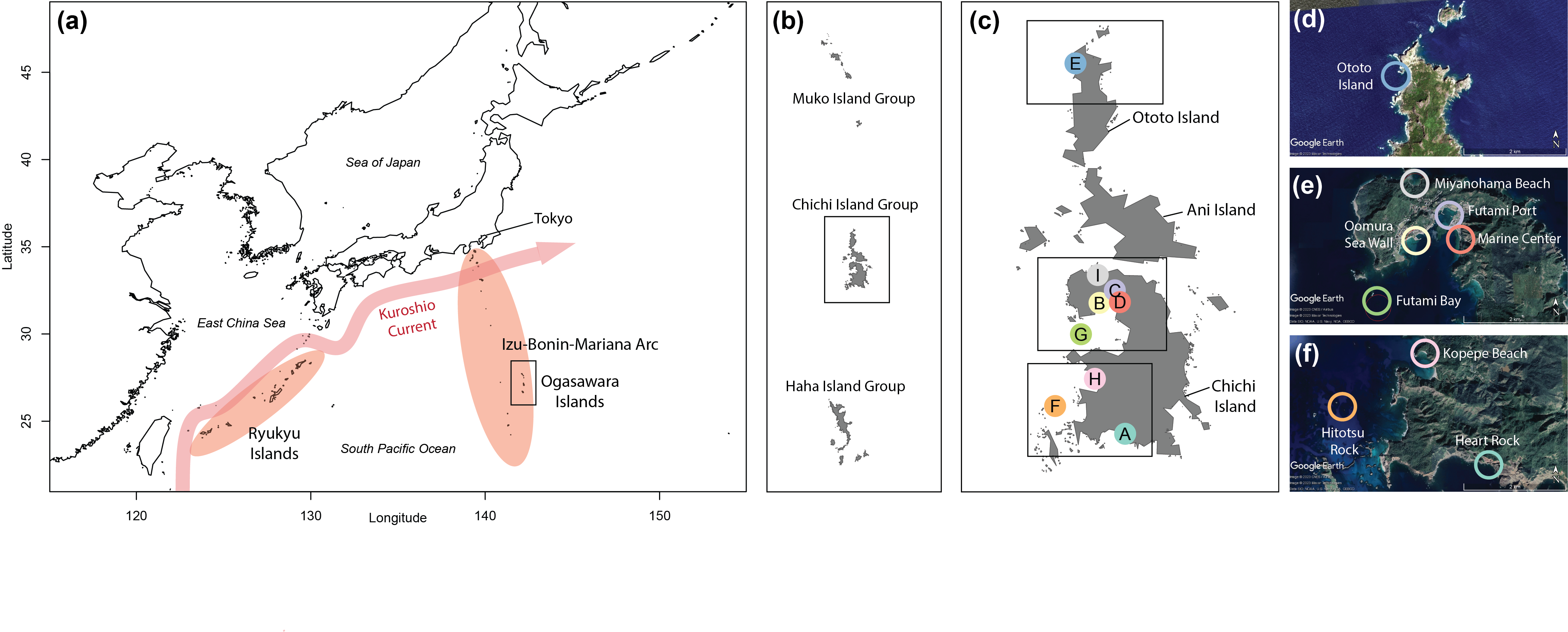
Composite image of maps showing the location of the Ogasawara Islands as well as the sampling sites for the study within the archipelago

Location of the Ogasawara Islands, south of Tokyo and outside the range of the warm Kuroshio current, as well as a map of sampling sites from which the seawater used in the study was taken. Credit: Ayşe Haruka Oshima Açıkbaş.
Date:
16 February 2024
Copyright OIST (Okinawa Institute of Science and Technology Graduate University, 沖縄科学技術大学院大学). Creative Commons Attribution 4.0 International License (CC BY 4.0).
Share on:


